Culvert

Bayview Oxbow

The Bayview Oxbow is located on the northern end of Alsea Bay where historical tidal wetlands once thrived. Efforts to restore these wetlands have been in the works for years and aim to reconnect the oxbow with Alsea Bay so that water can flow over the natural floodplain once again. The Wetlands Conservancy, which owns most of the western portion of the Bayview Oxbow, completed preliminary designs for restoration at Bayview Oxbow in 2019 in coordination with adjacent landowners and other stakeholders.

Currently, these designs have been picked up by the Oregon Central Coast Estuary Collaborative (OCCEC) which will be conducting a thorough technical review of culvert removal and bridge replacement in coordination with Lincoln County and partners. The Bayview Oxbow has been identified by OCCEC as a Focused Investment Partnership (FIP) project site and will receive a holistic approach to reconnect the oxbow and address infrastructural concerns with the larger goal of increasing resilience to sea level rise and other climate change impacts.

The Bayview Oxbow used to consist of extensive tidal wetlands, with tidal flows traveling into the oxbow during high tide and flowing out during low tide. This regime has been dramatically altered by dikes, tidegates, and other infrastructure. There were also spots within the oxbow complex that have been identified as historical forested swamp habitat, a once abundant wetland type along the Oregon Coast. In the past 150 years of land use, these wetlands have been converted for agriculture and industry.

1939 aerial image of the Bayview Oxbow referenced in text below.

The earliest photos of the Bayview Oxbow from 1939 show the site already diked, ditched, and utilized by early settlers. Land use priorities have contributed significantly to the decline of wetland habitat along the Oregon Coast; tidal wetlands declining by an average of about 60% and forested and scrub-shrub swamp by an average of about 95% since European settlement. Addressing these massive changes in wetland composition along the Oregon Coast is necessary to restore natural ecosystem processes that have been deeply disturbed by human land use.

In the next few years, project partners expect to begin restoration actions in response to a comprehensive project design. Utilizing a variety of grant sources and collaboration with a host of partners, the Bayview Oxbow restoration project aims to reconnect the oxbow with the Alsea Bay, promoting wetland wildlife and generating community resilience to projected sea level rise in line with landowner interests and concerns.
 

North Creek

Prime salmon habitat reconnected

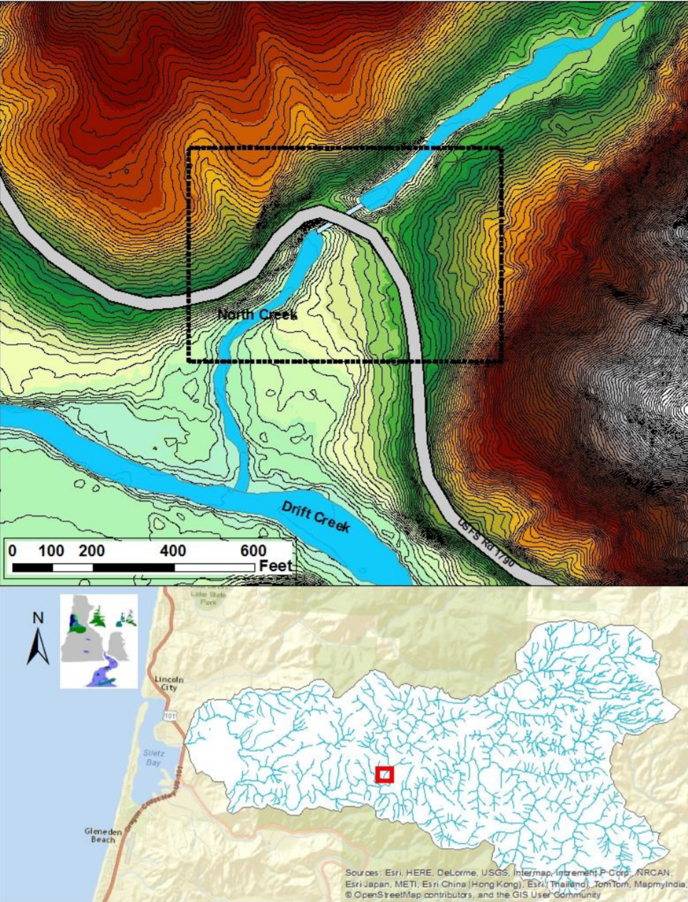
In 2019, a large culvert was put in place on North Creek, a tributary to Drift Creek in the Siletz River Basin, that allows salmon, steelhead, coastal cutthroat, lamprey, freshwater mussels, and other organisms to freely access sixteen miles of stream and wetland habitat for the first time in 62 years.

Contractors removed the old, severely undersized culvert and installed an appropriately sized, open-bottomed structure that doesn’t create a barrier to fish and other animals or to the downward transport of gravel or large wood which improves salmon spawning grounds downstream. The culvert replacement also allows for safe transport to and from popular forest recreation areas and Drift Creek Camp

Other collaborators assisted with funding, including the USFS, the U.S. Fish and Wildlife Service’s Fish Passage Program, Oregon Watershed Enhancement Board, Oregon Department of Transportation-Oregon Department of Fish and Wildlife Fish Passage Program, Trout Unlimited, National Fish and Wildlife Foundation, as well as a crowdfunding campaign organized by the Native Fish Society. 

Before (1980s)

After (2020)

The follow up

Students in Oregon Coast Community College’s Freshwater Habitats course are assisting in the data collection to determine how the new culvert is affecting the physical aspects of the stream and identify how organisms like salmon and aquatic insects respond to the newly opened channel. Volunteers with Trout Unlimited will continue eDNA sampling at 13 locations in the North Creek Watershed for two more years to determine the presence of difficult-to-survey target species such as lamprey and freshwater mussels. The efforts of these community partners will be complemented by stream temperature monitoring for three years by the USFS and the Environmental Protection Agency. The data resulting from monitoring work is expected to serve as an example for future large-scale aquatic organism passage projects.

OCCC students looking at samples in lab

OCCC students analyzing stream channel

Substrate change surveys

To learn more about this project, check out its coverage in the local news:

For even more nitty, sometimes gritty, details of what occurred throughout the nearly $1 million project’s timeline, click on the buttons below for bi-monthly breakdowns written by project partners as the work was happening:

Buckley Creek

Buckley creek is a direct ocean tributary roughly two miles north of Waldport, Oregon. The creek is occupied by native cutthroat trout, possibly brook lamprey and other aquatic and wildlife species. The site is an important freshwater wetland with beaver pond complexes and a diverse array of habitats. The Buckley Creek watershed area is roughly five square miles.

Previous Federal Emergency Management Agency projects replaced two 48” culverts on Buckley creek in the Silver Sands neighborhood upstream from the project area. These projects left one 48" culvert restricting flow on a private driveway. The culvert underneath this driveway is the last before the stream runs into the Pacific Ocean, just south of Driftwood Beach State Park. The owner dealt with flooding caused by the remaining 48" culvert in any heavy rainfall event.

To complete this project, we paired a willing landowner with an Oregon Watershed Enhancement Board small grant. The culvert replacement was done in late September of 2016, installing a new 84" squash tube culvert to increase wetland connectivity, alleviate fish passage issues and reduce flooding on adjacent properties. 

New squash tube culvert providing fish passage at high flows.