Large Wood Placement

Lower Drift Estuary

Regrowing lost habitats

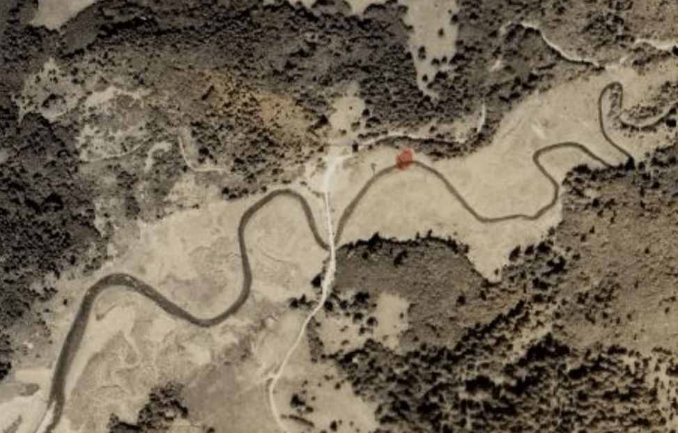
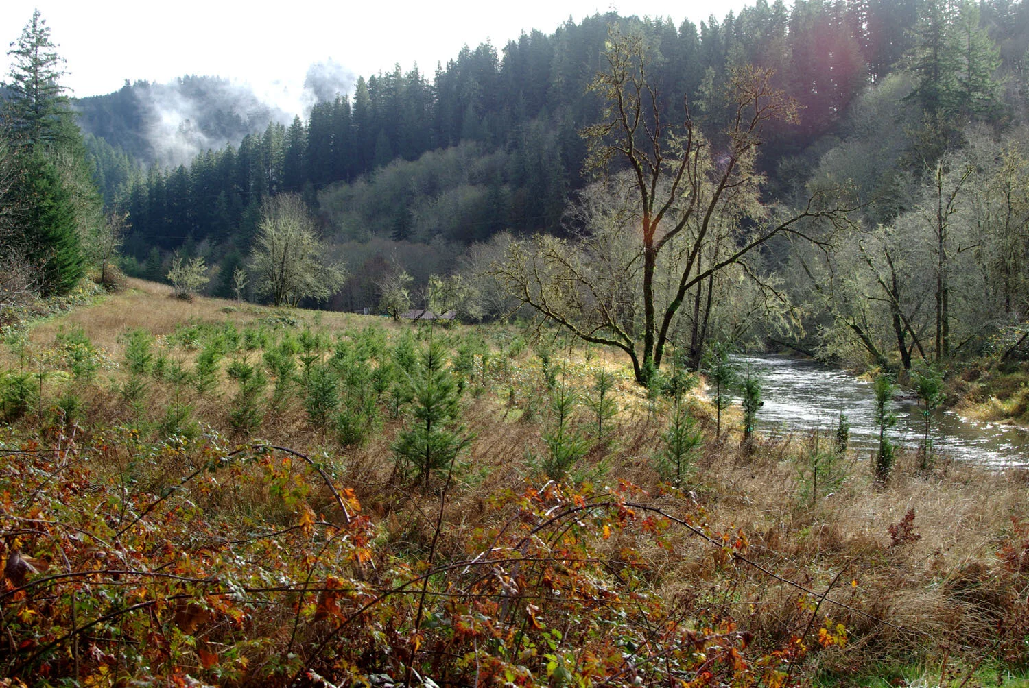
Drift Creek flows into the Siletz Bay just south of Lincoln City, where it forms a beautiful estuary habitat. The area is now part of the Siletz Bay National Wildlife Refuge, but the habitat has been severely degraded in the last 150 years. Several partners are restoring the wetland’s natural functions by removing tidal flow restrictions, digging new channels for the tides to flow through, and promoting native plants.


The Lower Drift project aims to restore roughly 40 acres of tidal wetlands in 2023 through the removal of dikes, restructuring and connecting of tidal channels, creating small mounds and planting native species, placement of large woody debris (LWD), and controlling invasive species. An additional 40 acres will be restored in 2024. These restoration efforts added to 86 acres of previously restored wetlands within Siletz Bay National Wildlife Refuge.

The value of estuaries’ ecosystem functions have not been prioritized in recent history. Instead, Oregon’s tidal wetlands have been diked, ditched, developed, or grazed to the point that the area of Oregon’s tidal wetlands has declined by an average of about 60%.

Once a common habitat along the Oregon Coast, forested swamps have declined by an average of roughly 95%. New research shows that forested swamps provide important ecosystem services such as shelter and foraging grounds for salmonids, multi-layered wildlife habitat and stream shading, and high levels of carbon storage in the soil. 

  • Wetlands are areas where water covers the soil, or remains close to the surface all or most of the year. Both marshes and swamps are types of wetlands. Marshes are wetlands that are dominated by soft-stemmed plants such as grasses. Swamps are wetlands that are dominated by woody plants such as trees or shrubs.

A forested tidal swamp (Photo by Laura Brophy)

In addition to directly supporting the preservation of estuary wildlife, the Lower Drift project plays a part in strengthening Oregon’s coastal climate change resiliency. Estuaries have a built-in system to adapt to rising sea levels. As sediment flows into the estuaries from the tides and river, it collects in vegetation and increases the elevation of the wetlands. Estuaries are also “blue carbon” ecosystems (such as mangrove forests and seagrass beds) which are even more efficient at storing carbon from the atmosphere than tropical forests!

How?

  • Improving topographic diversity higher elevation spots for spruce and native shrubs are present.

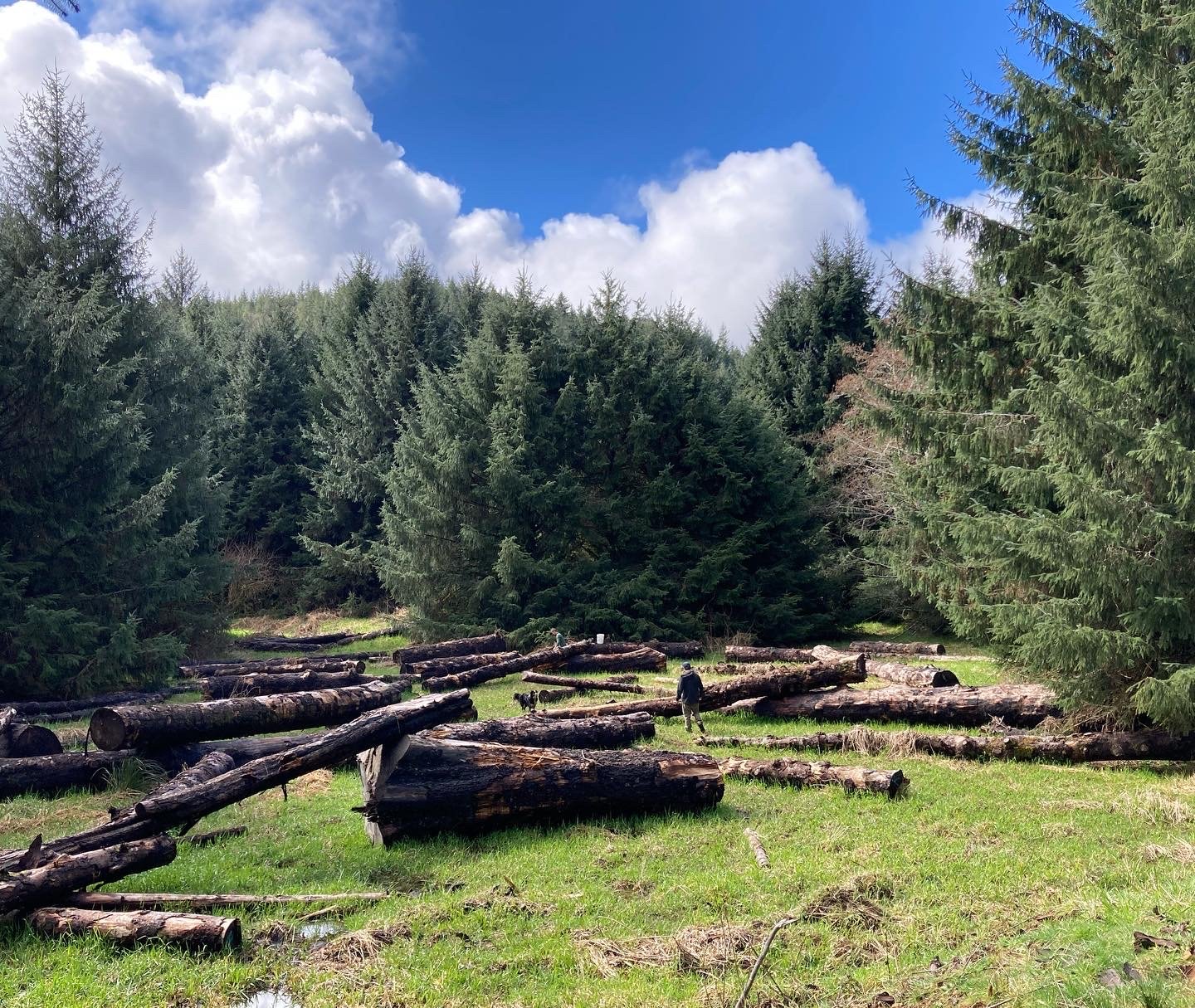
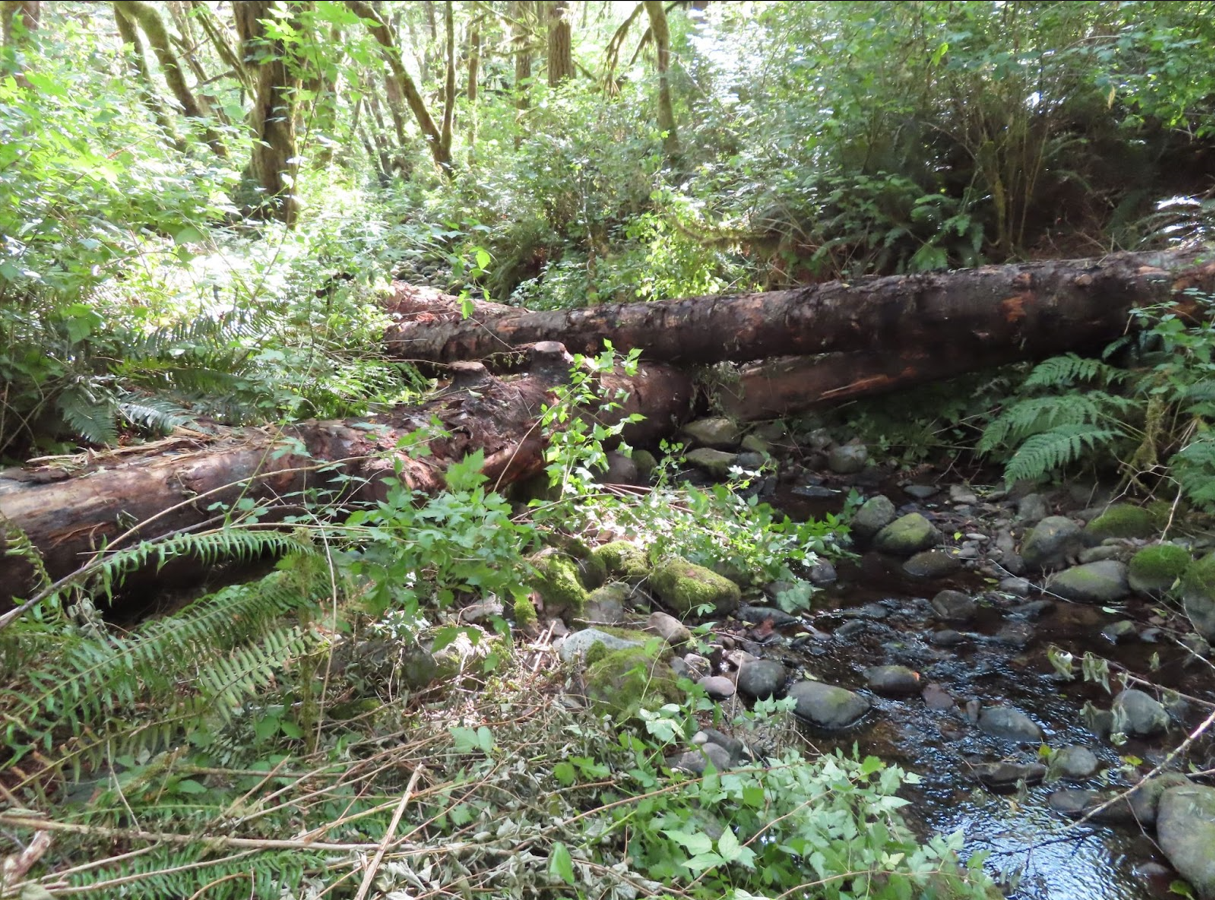
    Placing LWD to create potential nurse logs.

    Planting of spruce and native shrubs and managing invasive species. 

  • Removing tidal flow barriers such as old dikes, culverts, and riprap to allow for natural deposition of sediment.

    Placing of LWD to aid in catching of sediment.

    Creating elevation gradient to promote sediment deposition.

  • Increasing tidal channel connectivity through channel shaping and removal of tidal flow barriers.

    Placing of LWD to create shelter for aquatic species and coastal birds alike.

    Planting of native plants.


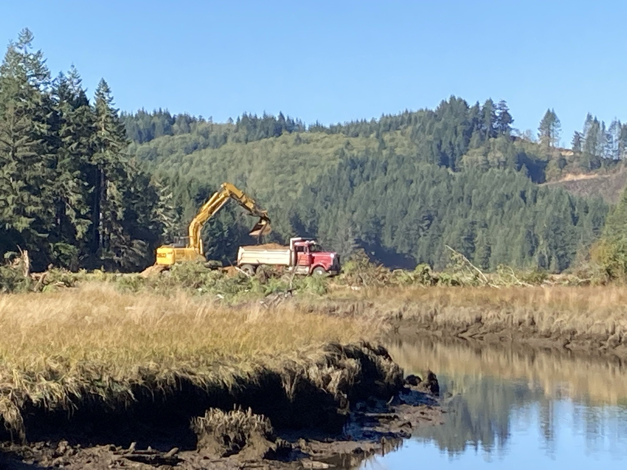
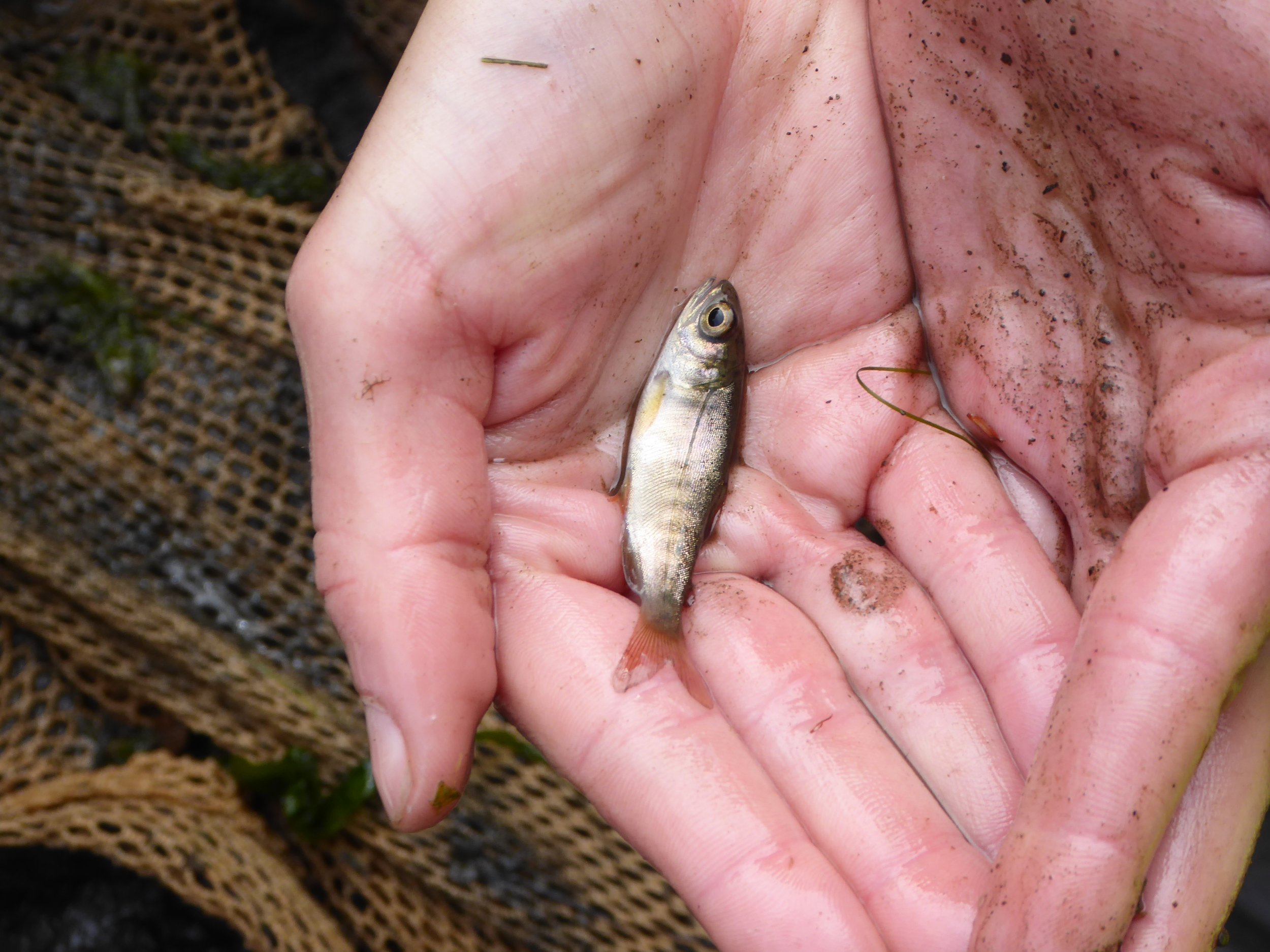
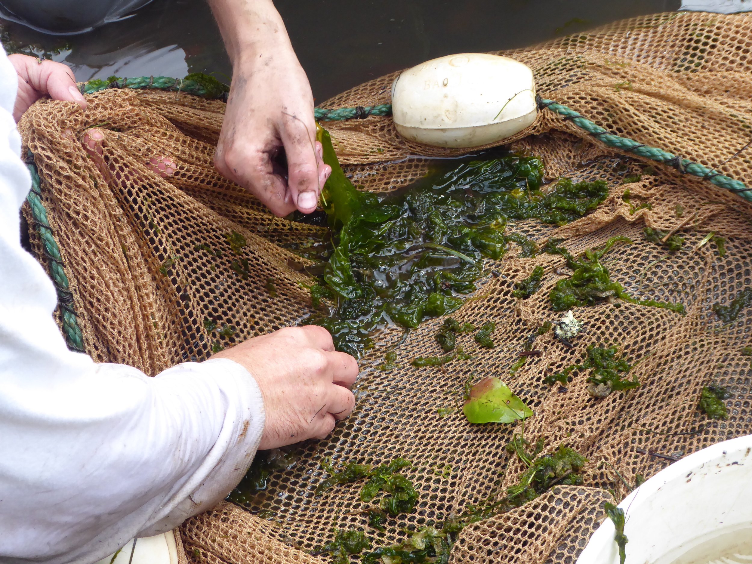
The first phase of the Lower Drift restoration began the summer of 2023 when stream diversion and fish salvage took place in July prior to the restructuring of tidal channels using large machinery. During fish salvage, species such as shiner perch, greenling, rockfish, gunnel, stickleback, and Coho salmon were successfully salvaged from the active work area and safely moved to habitat downstream. 


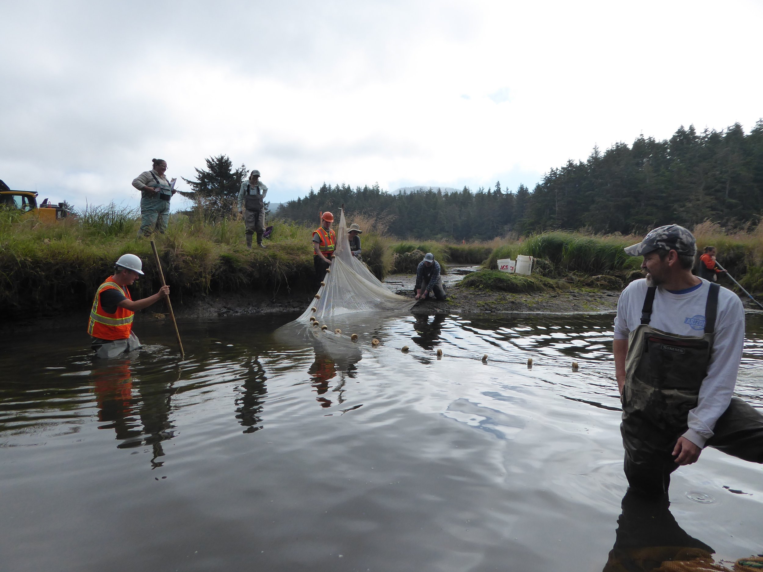
Project partners include US Fish and Wildlife Service, Oregon Coast National Wildlife Refuge Complex, US Forest Service, Bureau of Land Management, private landowners, the Lincoln Soil and Water Conservation District, the Wild Salmon Center, National Oceanic and Atmospheric Administration, and the Confederated Tribes of the Siletz Indians.


To learn more check out these resources:


Beaver Creek

A Basin Wide Effort

Near Seal Rock, Oregon, the ocean tributary Beaver Creek provides year-round habitat for endangered Oregon Coast coho salmon, as well as Chinook, winter steelhead, and other fish. Stretching from its headwaters in protected old growth forests to Ona Beach where it flows into the sea, the Beaver Creek watershed covers 21,532 acres and 42 miles of stream habitat. Despite harboring one of the healthiest existing coho salmon populations in the Midcoast region, it has been subject to extensive human alteration that reduced fish habitat over the last 100 years. MCWC has been working with a diverse group of partners to improve habitat in this basin through riparian planting, Large Woody Debris (LWD) placements, and reestablishing complex streams.

Michael and Sharon

Michael, MCWC Administrative Board Member, and Sharon live near South Beaver Creek where they enjoy wildlife watching and doing restorative home projects.

As is the case for many of Oregon’s coastal streams, North and South Beaver Creeks were converted for agricultural practices and simplified to best suit crop production. Areas “over by 101 [were] covered in fields, you know, it was pastureland.” says long-term resident and MCWC Administrative Board Member Michael Meagher. Many people in the area still derive livelihoods and family practices from agriculture. 

Segments of lower North and South Beaver Creek and their riparian zones are now part of the Brian Booth State Park. The acquisition of the land occurred from 2007 to 2009, private parcels being purchased with roughly $1.3 million in Lottery dollars and $400,000 from the USFWS Coastal Wetland grant. The headwaters reside in the protected Siuslaw National Forest, and private lands are settled between this management region and the protected stream mouth at Ona Beach. Private landowners in the Beaver Creek Basin have been crucial to restoration efforts that Midcoast and partners have been involved in. 

Kate

Kate, a long-term MCWC volunteer, has lived along the North Beaver Creek for 51 years and is passionate about having conversations on the importance of protecting natural processes and wildlife.

Kate Scannell, who moved to her current property along North Beaver Creek in 1972, has been a dedicated volunteer with MCWC for years and recognizes that in order to have successful restoration, “You are going to need the cooperation of the landowners.”

While she has not collaborated with MCWC on her property, she’s implemented restoration on her own, volunteered with MCWC, and supported a backbone of trust within her community.

“In essence, once you get to know somebody, you also get to hear a bit of how they feel and you know, “I should think about that, you know I should see how I can help them see a way to keep our paradise the way it is.”

In collaboration with other organizations, people, and communities, MCWC has been slowly but surely completing restoration projects across the entire Beaver Creek Basin with a shared goal of protecting this space which is home to people and wildlife.

South Beaver Creek

Drone photo of the Beaver Creek Community site on South Beaver Creek during restoration.

This ongoing project has increased the complexity of a drainage channel artificially straightened for agricultural purposes. The previous drainage channel restricted the stream’s access to the smaller tributaries and seasonal floodplain. After restoration, the tributaries, freshwater wetland, and broad floodplain offer complex habitats for fish and aquatic organisms.

After removing about two acres of invasive Reed Canary Grass (RCG) by scraping with an excavator, the drainage ditch was filled in and the historic channel reconnected. LWD were placed in the new channel, and the scraped area was heavily seeded and replanted with native species.

The most recent restoration on the South Beaver Creek and neighboring streams has been dependent on collaboration from 7 private landowners. These properties, which lay between protected lands in the headwaters and downstream, are crucial to creating a mosaic of restoration projects throughout the South Beaver Creek water system.

North Beaver Creek

Claire and Eric

Claire and Eric have owned their North Beaver Creek property since 2000 where they have independently, and in collaboration with MCWC, restored the space through plantings and LWD placement.

This ongoing project seeks to address poor stream habitat on the privately-owned, low-gradient sections of North Beaver Creek to increase habitat value for coho salmon and other aquatic species from the headwaters to the mouth. Through a combination of work on protected public lands and private collaborators, the North Beaver Creek restoration project will help realize crucial coho rearing habitat and boost watershed-wide resilience.

When Claire Smith and Eric Horvath purchased their North Beaver Creek in 2000 they already had big plans to restore the area.

“We’ve planted western red cedar, Sitka spruce, and western hemlock, probably 2,000 of each,” says Eric, because the property had been a clear cut.

Through MCWC they were able to source many of those trees and in 2007 MCWC and partners placed LWD along their section of the North Beaver Creek to promote complex habitats. When we revisited the LWD placements this month, one of those logs placed in 2007 had been used by a beaver for their dam.

Beaver dam built on log placed in 2007 by MCWC and partners on Claire and Eric’s property. (photo taken on 08/18/2023)

The ongoing results of prioritizing environmental restoration on their property, such as seeing salmon populations grow, is something that Claire sees as potentially impactful across the community.

“. . . I feel like there are these things that are absolutely shared experiences that many many people have, like seeing the salmon in the water and it’s an experience that people really, really appreciate and, you know, look forward to.”

The ongoing restoration work by MCWC and partners on North Beaver Creek has already involved cooperation with multiple private landowners and collaborators such as Claire and Eric hope that projects such as theirs could increase visibility and interest in environmental restoration.

Shared goals

Private landowners have been key to the environmental restoration that has taken place across the Beaver Creek watershed so far. As MCWC and partners continue with the most recent projects, the cooperation of community members will not only create a wider area of land that has seen restoration actions, but will potentially strengthen the visibility of such work and connect people with resources that can assist restoration on their property.

In addition to the private landowners, project partners in this basin include The Wetlands Conservancy, Oregon Parks and Recreation Department, Seal Rock Water District, The Lincoln Soil and Water Conservation District, and the US Forest Service.


Poole Slough

Poole Slough is a tidally influenced channel in the lower reaches of Wright Creek, just before it flows into the Yaquina River Estuary.

Map of planting sites and road removal.

Poole Slough was dramatically simplified historically by removing large wood, building roads that are no longer in use, and the removal of wetland trees and shrubs. These actions reduced the quality and quantity of habitat for fish and wildlife.

1939 aerial photo showing simplified channel and now obsolete logging road

MCWC worked with partners to remove the obsolete road to allow full tidal exchange through the Slough, now owned by VanEck Forest Foundation and The Wetland Conservancy. This was paired with several large wood placements to increase channel complexity and encourage formation of side channels.

Excavator lowering road

Dumptruck removing fill

Water flowing freely over road at high tide

Our crews also planted spruce and crabapple along the slough to create scrub-shrub swamp habitat, over 90% of which has been lost along the Oregon Coast. These trees will provide large wood input to the slough long term.

Areas around Poole Slough were identified as future tidal wetlands when sea levels rise in our 2017 Landward Migration Zone study. To increase resiliency long term to climate change, large wood was placed in the areas identified. As they decompose, they will act as nurse logs for young spruce trees. In the meantime, they are habitat for birds, insects, mushrooms, and all the other beings that depend on fallen trees.

Partners include ODWF, VanEck Forest Foundation, ODFW, The Wetlands Conservancy, USFWS, The Forest Service, Pacific Forest Trust, and others.

Little Lobster Creek

Warm water temperatures are detrimental, and can be fatal to juvenile salmon. Little Lobster Creek in the Alsea Basin is known to reach unsuitable temperatures. A lack of fallen logs in the stream from the days of homesteading lead to a loss of salmon spawing gravel, since high flows washed the subrtrate away without something in the creek to hold it there. MCWC worked with volunteers and partners to create long term solutions to these problems.

Cedar being planted in grazing exclosure in the riparian area

MCWC and partners (including a team of volunteers) reestablished native conifers in the riparian area for long term shade and wood recruitment to the stream, and placed a significant amount of large wood within the channel to trap migrating substrate in the spawning grounds. The Siuslaw Collaborative Watershed Restoration Program and Oregon Watershed Enhancement Board funded the implementation of this work and the project management, and a large match was also secured from the BLM through donating wood used in the project.

Big Creek

Big Creek is an ocean tributary flowing directly into the Pacific Ocean, about 10 miles south of the town of Yachats.

The site, now owned by Oregon Parks and Recreation Department (OPRD), was degraded by land clearing and grazing, removal of large wood from the stream, invasive plants, and unnatural fill in the floodplain. These actions greatly impacted instream complexity, floodplain and wetland connectivity, and riparian vegetation; all factors that limit Oregon Coast Coho (OCC) and other salmonid production.

This project improved instream, floodplain, and wetland function by removing introduced fill in 14 acres of floodplain, instream material placement to remedy channel incision, and placement of large woody debris.

Wood placement includes 10 instream log structures and over 200 pieces on the Big Creek floodplain. This increased large wood loading will further increase connectivity and side channel development over time.

Riparian planting and seeding will improve the functioning of the riparian zone and enhance a pollinator corridor between two known reproduction sites for the endangered Oregon silverspot butterfly.

Project partners include OPRD, Oregon Department of Fish and Wildlife, US Forest Service, Siuslaw SWCD, Oregon Department of Transportation, and the Confederated Tribes of the Coos, Lower Umpqua and Siuslaw Indians.

Record Creek

Record Creek is a tributary to Swamp Creek, one of two major branches of the Bummer Creek sub-watershed within the greater South Fork Alsea system.

Riparian trees were historically cleared up to the stream, like many other areas in the Northwest. Eventually alders colonized the area, dominating the forest canopy and stalling later stages of forest from developing. While alders adequately provide the important function of shading the stream, their logs degrade quickly once fallen and do not contribute to creating the habitat complexity that fish and wildlife rely on to the degree that native conifers like Western red cedars do.

With funding from OWEB and log donations from BLM, in 2019 MCWC and placed 5 logjams over a 0.3 mile reach of Record Creek in order to trap and sort spawning gravel, form pools, and increase overall habitat complexity and floodplain connection. To provide an even longer term source of large woody debris to the stream, volunteers helped in planting 150 native Western red cedars in the alder-dominated riparian area of Record Creek. These trees will never be cut down, and will continue benefiting the habitat throughout their lifespan and beyond. 

Ernest Creek

This project is located on the beautiful Thyme Garden property on Ernest Creek, a tributary of Crooked Creek in the Alsea River watershed which provides habitat for coho and Chinook salmon, cutthroat and steelhead trout, and lamprey species.

This project will improve stream complexity and riparian and aquatic habitat conditions by adding large wood structures and planting trees to supply wood for the stream long term. Current wood levels in the stream are significantly below ODFW recommended values, and has reduced complexity, floodplain connectivity, and increased channel erosion. Restoration work in 2002 reconnected Ernest Creek into its historical channel but experienced channel incision again because the lack of wood in the stream and soft, sandstone substrate.

MCWC and partners placed a total of 16 large wood structures on 0.7 stream miles, planted conifers on two acres of riparian habitat to increase potential for long term large wood recruitment, and . Project partners are Thyme Garden, another local landowner, Georgia Pacific, Northwest Oregon Restoration Partnership, and Bio-surveys LLC.

Mill Creek

When large trees fall into a stream, they divert the energy of water and create complex arrangements of pools and riffles that are crucial for young salmon and other animals to survive. Extensive logging and human alteration has dramatically reduced the amount of wood and complexity in streams.

Pool created by large conifer wood placement under an alder forest.

In partnership with ODFW, MCWC installed 679 logs in 6.8 stream miles of salmon habitat in Mill, Gunn, and Cerine Creek. The goal of this project was to restore habitat complexity for young salmon. Large wood accumulates spawning gravel, provides substrate for prey to grow, and creates deep pools and slow water for young fish to live in.

Map of Large Woody Debris sites (LWD), Temperature, Life Cycle Monitoring (LCM), and Benthic Macro Invertebrate (Macro), and geomorphology site (Geo) locations.

Because the mouth of this basin has housed ODFW’s Life Cycle Monitoring (LCM) site for over 20 years, there is long term data about the numbers of juveniles and returning adults in this area. Strong before and after data make this project an excellent opportunity to study the effectiveness of projects like these.

This project is being followed up by an extensive Effectiveness Monitoring project to determine the effects of the large wood placement on fluvial geomorphology, aquatic habitat, benthic invertebrates assemblages, overwinter survival of juvenile coho, and overall coho smolt production for the watershed.

Field tech conducting Aquatic Habitat Inventory study.

Partners include: ODFW, Weyerhaeuser, Oregon DEQ, and OSU College of Forestry. The study is designed to inform future in-stream restoration priorities, large wood placement design, land use management, coastal coho recovery goals and objectives, and limiting factors analyses for coho salmon production.