Yaquina

Poole Slough

Poole Slough is a tidally influenced channel in the lower reaches of Wright Creek, just before it flows into the Yaquina River Estuary.

Map of planting sites and road removal.

Poole Slough was dramatically simplified historically by removing large wood, building roads that are no longer in use, and the removal of wetland trees and shrubs. These actions reduced the quality and quantity of habitat for fish and wildlife.

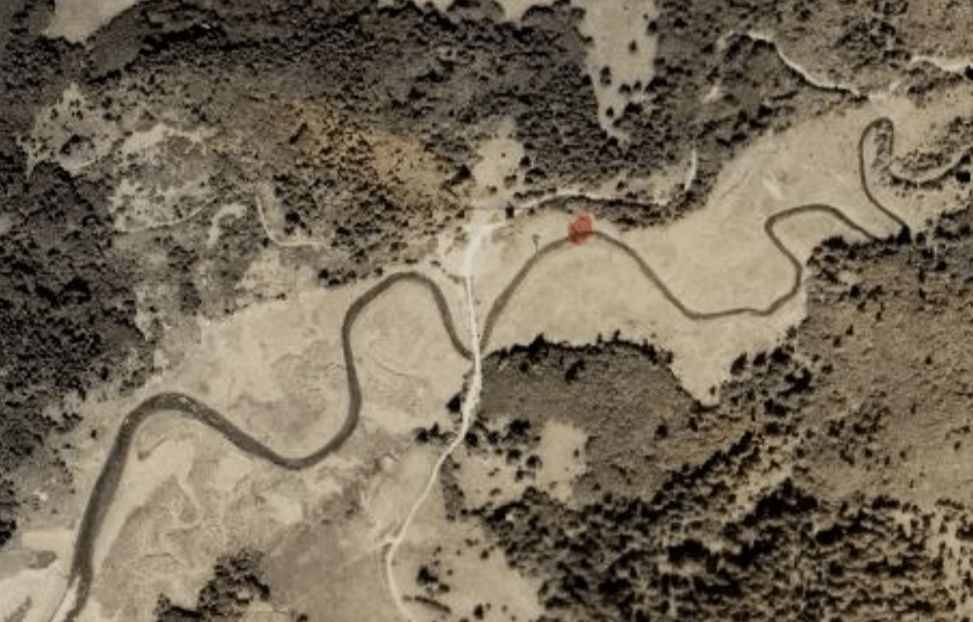
1939 aerial photo showing simplified channel and now obsolete logging road

MCWC worked with partners to remove the obsolete road to allow full tidal exchange through the Slough, now owned by VanEck Forest Foundation and The Wetland Conservancy. This was paired with several large wood placements to increase channel complexity and encourage formation of side channels.

Excavator lowering road

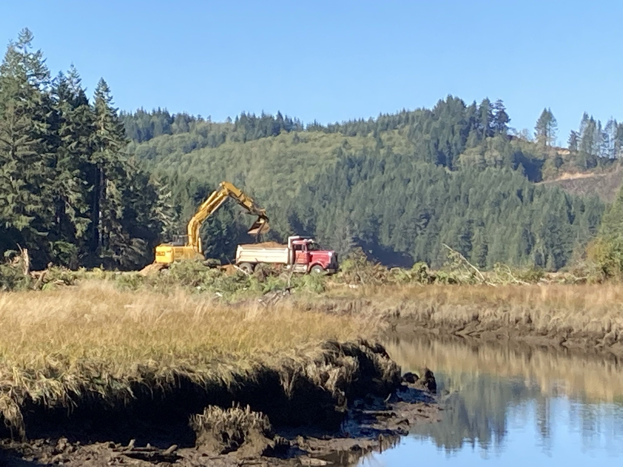
Dumptruck removing fill

Water flowing freely over road at high tide

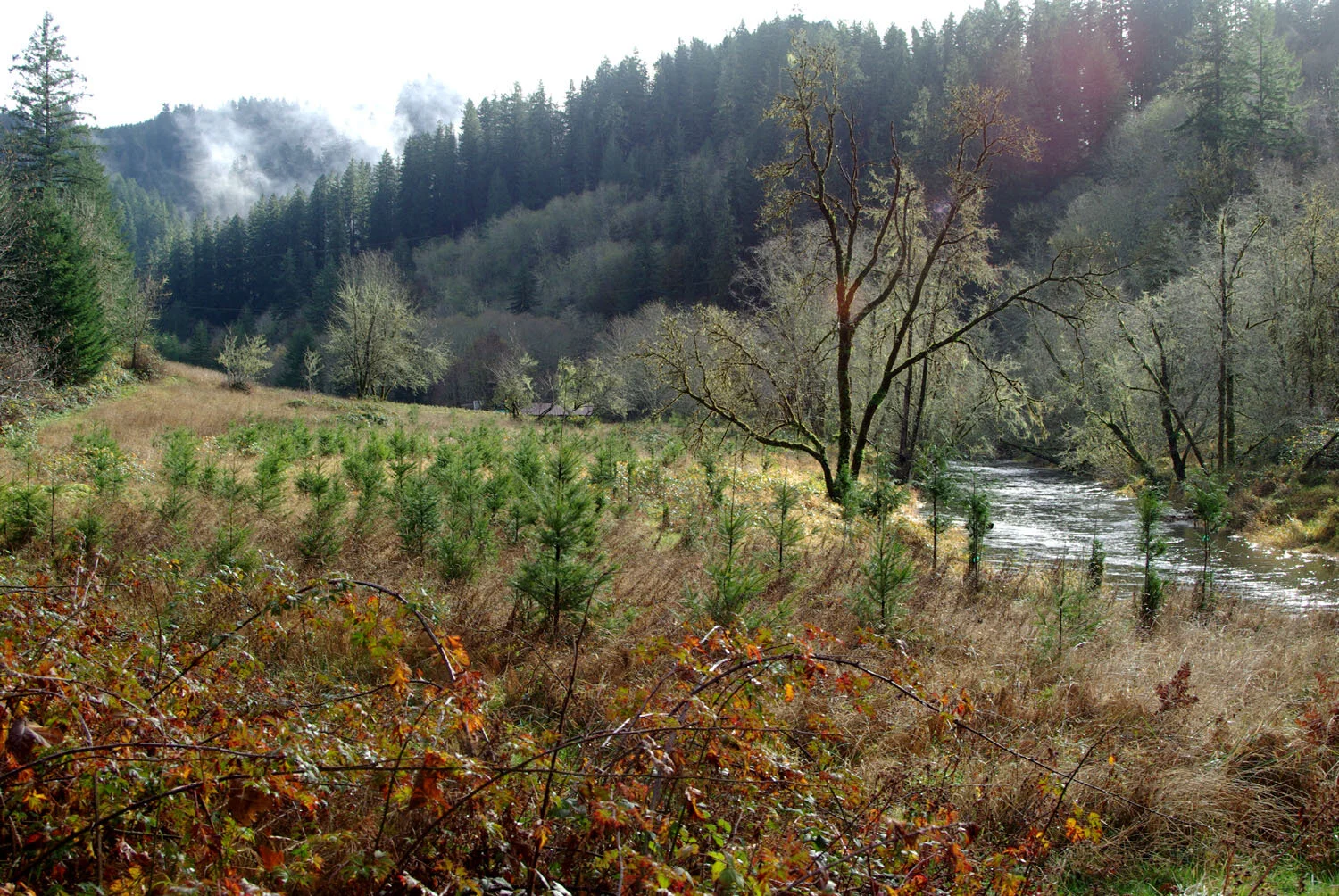
Our crews also planted spruce and crabapple along the slough to create scrub-shrub swamp habitat, over 90% of which has been lost along the Oregon Coast. These trees will provide large wood input to the slough long term.

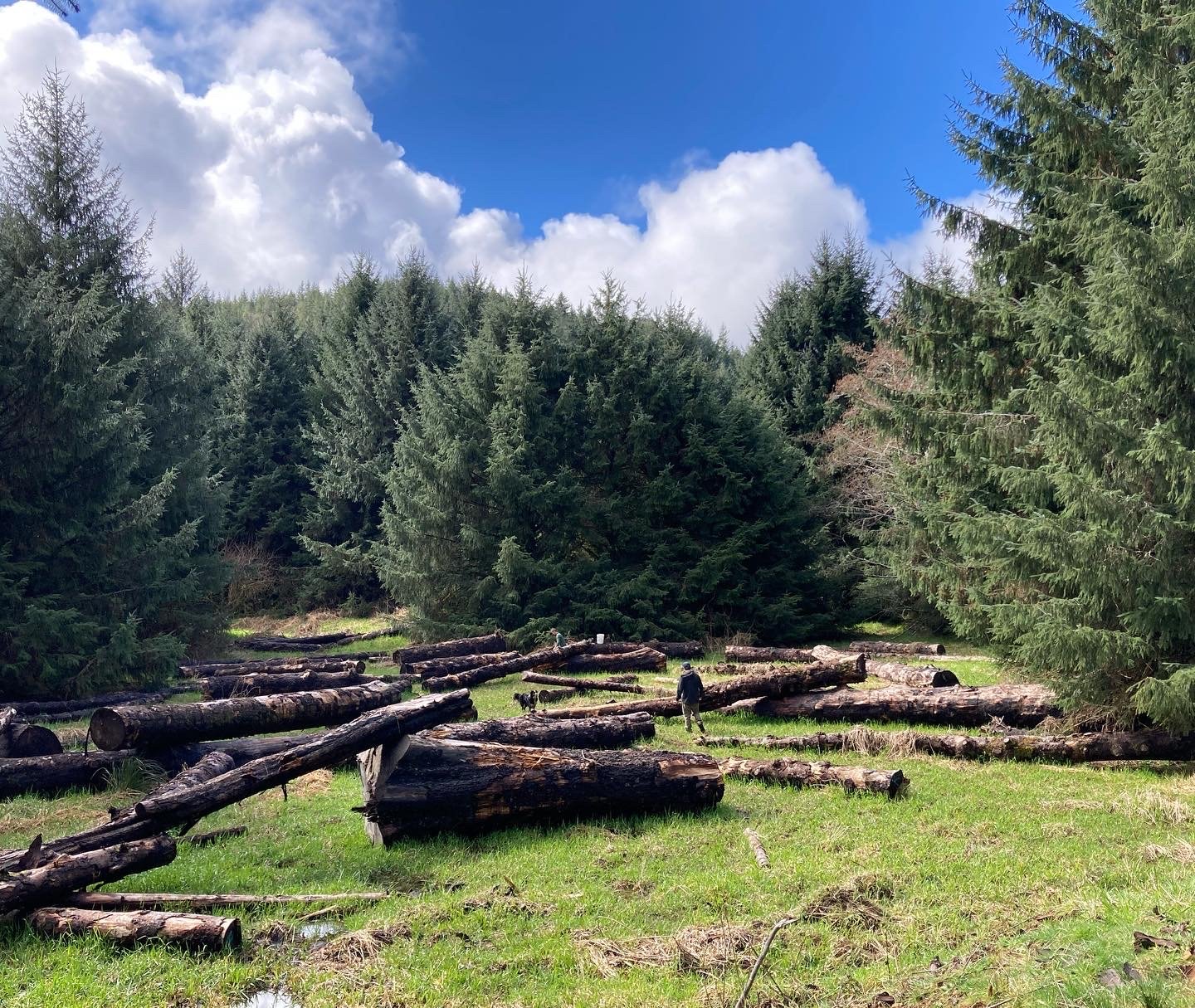
Areas around Poole Slough were identified as future tidal wetlands when sea levels rise in our 2017 Landward Migration Zone study. To increase resiliency long term to climate change, large wood was placed in the areas identified. As they decompose, they will act as nurse logs for young spruce trees. In the meantime, they are habitat for birds, insects, mushrooms, and all the other beings that depend on fallen trees.

Partners include ODWF, VanEck Forest Foundation, ODFW, The Wetlands Conservancy, USFWS, The Forest Service, Pacific Forest Trust, and others.

Yaquina Estuary (Y27)

Reconnecting Tidal Marshes

The tide has large influence on rivers, even miles upstream of the ocean. High tides create temporary aquatic habitats that are extremely important to juvenile salmon and other fish.

Across the Yaquina River from Elk City Road near Cannon Quarry Boat Launch, MCWC and partners improved habitat for coho, chum and Chinook salmon by restoring the tidal marsh known as “Y27”.

Map of the Y27 working area

Y27 at high tide

Y27 at low tide

Contractors removed sections of the failing dike and filled artificial drainage ditches to encourage water to use reconnected natural channels and newly dug channels. We protected spruce trees from a 2001 restoration planting project.

Our crew planted the entire site with spruce and other wetland species and will tend to them over several years to establish forested tidal wetland habitat and control invasive species. Trees and root wads were placed into the channels to immediately provide cover for fish.

As tides carve the channels we started and form new ones, the river will deposit its sediment and actually raise the elevation of the area over time. The new sediment and vegetation will increase the areas resiliency to flooding and sea level rise. This project is informed by the history of restoration on this parcel and estuary science from around the coast.

Funding for this work was received from the Oregon Watershed Enhancement Board, the US Fish and Wildlife Service Fish Passage Program, with additional support from the Pacific Marine and Estuarine Fish Habitat Partnership and the Oregon Wildlife Foundation. Project partners include the City of Toledo, the Confederated Tribes of Siletz Indians, the Wetlands Conservancy, Pacific States Marine Fisheries Commission, Oregon Department of Fish and Wildlife and US Fish and Wildlife Service Partners for Fish and Wildlife.


News articles about this project